

Chaelundi National Park: Finding Lucifer’s Thumb at sunset
A friendly local from Bellingen let me in on a far Northern NSW secret, and now I’m torn over whether or not to write about it, as I’d personally like this place to stay clean and quiet.
But, as with all road-trips, the story that goes with this trip is far too good to keep to myself.
As we passed through Dorrigo, we checked the map to make sure we were going in the right direction. There were two turn-offs, you see: one that takes you to Chaelundi Road after passing through Dundurrabin, or the other that goes through Marengo, along Hardens Road.
We chose Chaelundi Road, as we noticed that Hardens road would be the better way for us to head out, so that we could head straight to Ebor Falls.
Anywho, at the start of the gravel road, Mark pointed to a ‘no set speed limit’ sign. Calm down Schumacher, don’t get too excited, the road has a fair few little pot-holes, and lots of lose rock and long sticks.
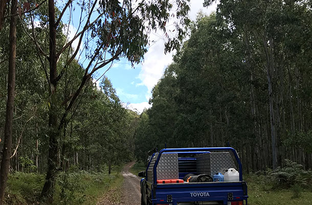
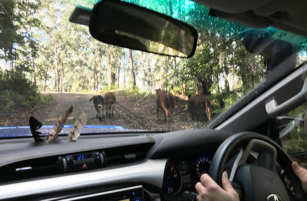
As I drove up a steep hill, we saw a small herd of cows to the right hand side of the road. “What the? Isn’t this national park?” I’ll get back to that one later…
You’ll pass through thick bush, up steep hills, down steep hills, pass cows in paddocks, drive through clearings thinking, “Gee, this looks like a farm…”
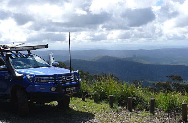
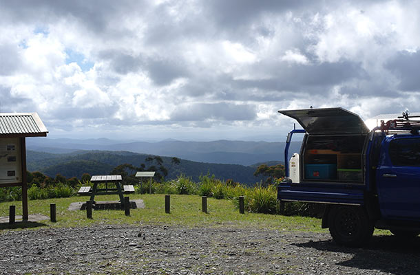
Mount Hyland Lookout
We took the turnoff to Mount Hyland Lookout, where we made lunch and enjoyed the views.
Misty Creek Lookout
You’ll come to a sign that reads “Misty Creek Lookout” on your long drive down to Chaelundi campground.
Don’t make the mistake of driving straight past this. It’ll take you 45 seconds to walk from your car to the lookout, where you’ll be blown away with views of forested mountains rolling off toward the horizon.
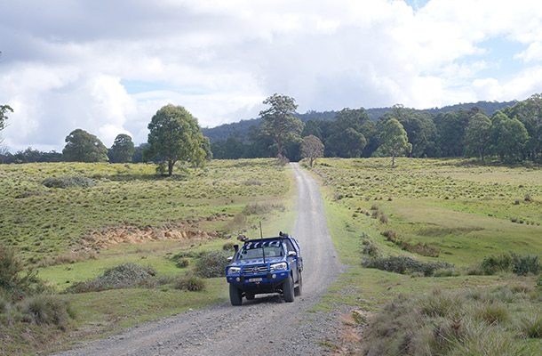
Chaelundi Campground
Not too far down the hill from Misty Creek lookout, you’ll finally reach Chaelundi campground.
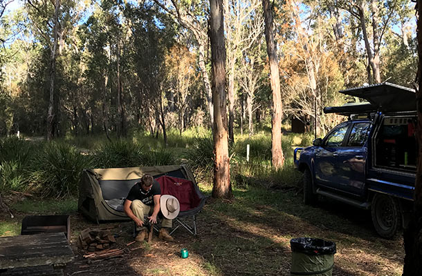
We set up the swag, sat down for a quick cuppa, and then set off for an afternoon of hiking.
Chaelundi Falls: 30 min return hike from Chaelundi Campground
Begin this short hike from Chaelundi campground at a sign that reads ‘Escarpment Track’.
You’ll reach the falls after a short walk through ferns and tall grasses. You’ll see Chaelundi falls from above, so the waterfall actually isn’t in good sight. There really isn’t any safe way to climb over the fence and go for a swim… It’s a pretty steep and deadly drop from the top – so go forth at your own risk.
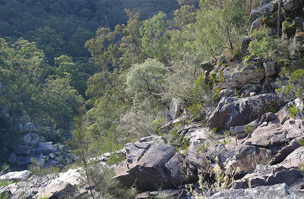
Sorry, this was the best I could capture…
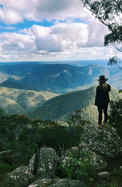
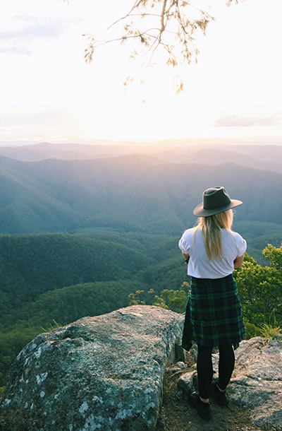
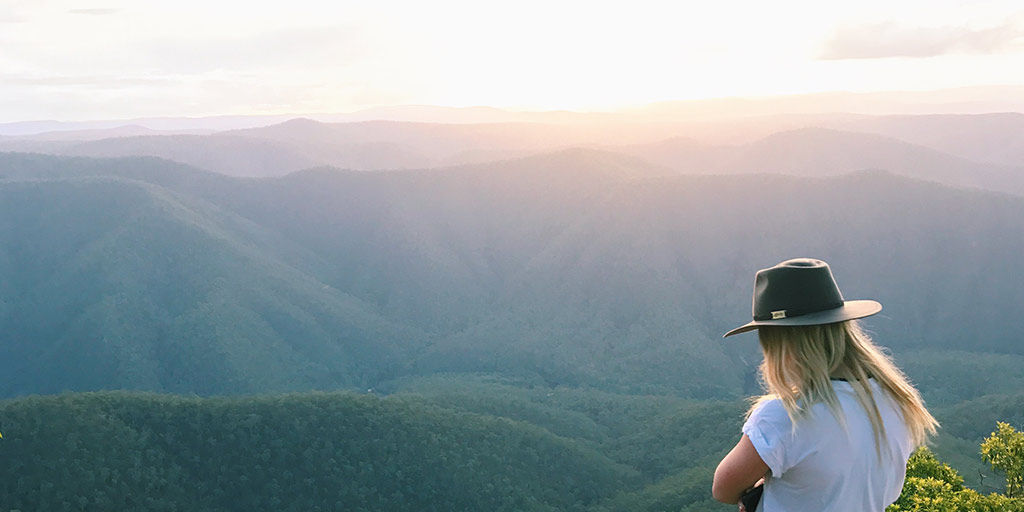
Lucifer’s Thumb: 1.5hr return hike from Chaelundi Campground
Continue along the track after stopping to see Chaelundi Falls, and take the right turn off when you read to a sign that suggests left for the Escarpment track, or right for Lucifer’s Thumb – pretty simple, really.
You’ll wander along a rocky path between long grass and tall trees, until you reach a wall of boulders and rocks. Wedge yourself between these rocks, and watch your step as you peer over Lucifer’s Thumb to see Guy Fawkes River below.
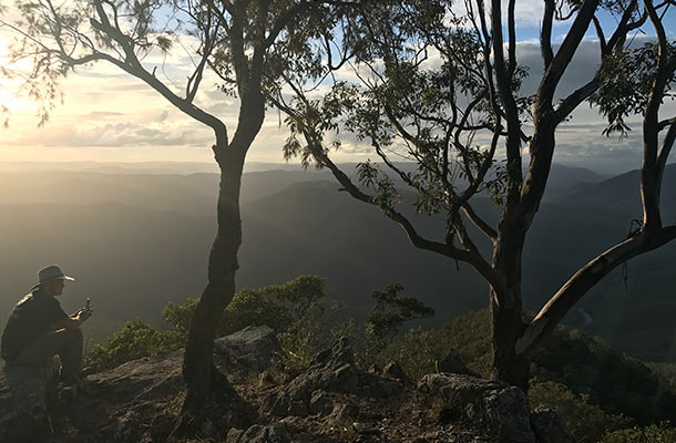


Stay a while, take in the fresh air, watch the sunrise or sunset – and thank God for banishing Lucifer to Chaelundi National Park.
Common Complications
So, about that whole “farm land” thing.
Careful when you’re leaving Chaelundi National Park – we thought we were following Hardens Road until the nav-man suddenly told us we were on “Unnamed road, near Marengo”.
We continued to follow along what we thought was the correct road, opening cattle gates, closing them behind us. Opening more cattle gates, closing them behind us, again.
Until we got to this gate:
“MILK ME” said the cows that probably aren’t even dairy.
If you reach that fence, you’ve gone too far.
Likely that the very friendly farmer, Mick, will see you, and come up to the gate to let you pass through.
“You don’t even want to know how often this happens,” Mick said as he approached the gate.
“I don’t know where we went wrong – maybe that first cattle gate?” I said back, with a nervous laugh.
“Usually we get folk arriving at our front fence, asking how to get to the next part of Hardens Road. You see, the issue is, Harden was the name of the farmer who owned this farm back in the ’60s and ’70s – since then, Hardens Road has been closed. I’ve called Google, I’ve called Hema – but nope – they won’t remove this road from the GPS.” He told us.
Mick is awfully friendly, so if you do make the same mistake we did, he’ll likely let you through. But don’t do it on purpose – that just isn’t fair.
My advice? Take Chaelundi Road instead. There’s hardly any way you could get lost on that long track.
Where we stayed:
- Chaelundi campground is hidden deep inside Chaelundi National Park.
- Plan your route carefully, as there are two different ways into the campground, Chaelundi Road is the easier option to follow.
- There’s wood supplied there, but not much – so try to bring your own as well.
- Camp fees are $5 – there’s an honesty box. USE IT.
- There’s a toilet block – and toilet paper.
May 27, 2017


Join the discussion!