

A treacherous day hike to Mirrador Las Torres in winter
I’m a clumsy bugger in really simple situations. Drop me on some boulders covered with ice in Patagonia’s Torres del Paine National Park, in middle of winter when the rangers have gone home, and you’ve got a potential conundrum.
In the Magallanes region of Chile’s far south, Torres del Paine is where you’ll find the distinctive three peaks of the Paine mountain range extending 2,500m above sea level. At the base, a small lake makes for great photos. To reach it, travellers must take a day-hike from Hotel Las Torres. But hold your horses: just how easy is it to reach the base of these three granite pillars?
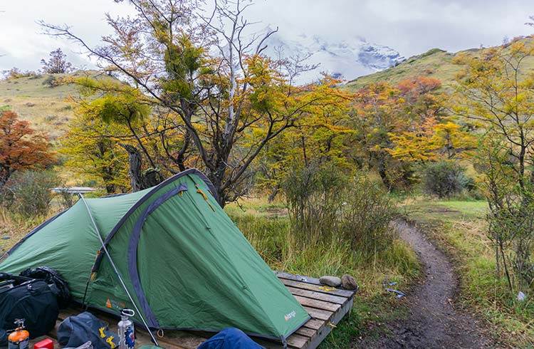
We were on our final day of hiking the five day W Trek through Torres del Paine. Starting at Paine Grande on day one, we first walked to Grey Campsite before backtracking to Grande and up to the Frances Valley. We’d been lucky to have minimal rain and brilliant sunshine on the first four days.
On day five when we woke at Central campsite before the sun was up, I couldn’t see the stars and immediately knew we were in for a cloudy day.
We’d been hiking for almost four hours, stopping just once to stretch and eat a muesli bar. We were saving our sandwiches to enjoy a celebratory picnic when we reach the top.
I looked up to see three people a mere 20m above us, very slowly etching their way across an icy walkway that sharply dropped hundreds of metres to the side. I wondered how soon we too would hit the icy path, but kept pushing on, scrambling up the rocks.
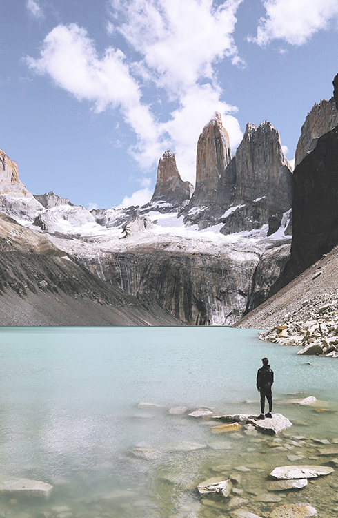
The 18km return hike to the base of Las Torres can easily be done in one day. Starting at Las Torres Hotel and ascending up a rocky slope towards the lake, hikers are given shade from tall trees, and will hear the powerful river of ice-melt gushing in the valley below.
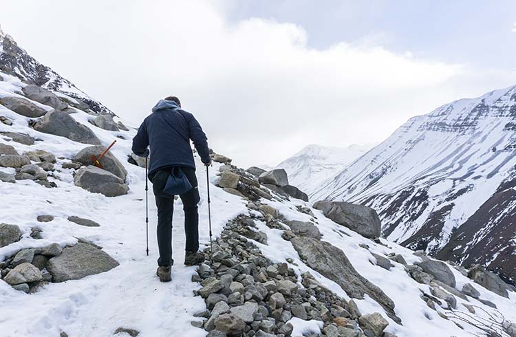
The hike steadily inclines through the forest along a reasonably wide dirt path, followed by a section of boulders to scramble, and finally a rocky path – with a steep drop – that leads you to the lake.
Keeping our eyes peeled for the yellow and orange trail markers makes navigating the boulders easy in winter. Snow had fallen overnight, and I could see how some hikers might get lost in the depths of winter after a heavy dump of snow.
The park technically closes on the 31st April each year marking the end of autumn, or more importantly, the beginning of a cold, dark winter. We’ve never been fond of crowded trails, and decided to hike at the start of winter to see the park without battling hundreds of tourists jostling for their spot on the trail.
When we arrived in the town of Puerto Natales a few days earlier, everything was quiet. Shops were closed, rental hiking equipment stores were shut for the season, and to make matters worse, TripAdvisor’s top pizza restaurant wasn’t open for business. We were beginning to worry our decision to hike off-season was a terrible idea.
The famous Patagonian winds were blowing a gale in the streets of Puerto Natales. We couldn’t take a simple stroll from our hostel to the grocery store without layering up in all our cold-weather gear. If these were the conditions in town, what on earth had we signed up for in the park?
During the last section of the hike, Mark and I were faced with ice and snow covering the path, occasionally forcing us to go off the marked trail where non-slippery rocks provided a ~safe~ path. I looked ahead to see Mark wedging his hiking poles between two rocks before taking a step. If he was struggling, what hope did I have?
“Mark, I think I’m going to have to call it quits.”
“What do you mean, we’re 250m from the top?” Mark turned to see the terror in my eyes as I stared down at the icy path, where my foot was slowly sliding centimetres closer to the steep drop.
“Have you ever got that feeling like this is where you’re going to die?” I gulped, hoping Mark wouldn’t think I was being a wuss.
Our four hour slog ended here, where we decided to turn back. We were so close to the top we could literally see people walking slipping just above us. Making the decision to turn around wasn’t easy, but onboard the mini-van back to Puerto Natales that afternoon, a guide and his crew of hikers were chatting amongst themselves about their expedition to the top. The leader of the tour group, who has hiked this trail hundreds of times, tells us he slipped and fell on his arse. Another member of the group fell face first as they walked the slippery path.
At that moment, I knew I’d made the right decision. I guess when you know, you know.
Travelling to South America and need inspiration? Here’s how we travelled the continent in 3 months.
January 16, 2019


Great post 🙂